The distinction depends on what accompanies the shape. At a confirmed settlement, researchers can connect walls with tools, burials, pottery or inscriptions. At a natural formation, the strongest explanation may come from the rock's internal layers or mineral chemistry. An impressive outline starts an investigation, but does not establish who built something, or whether anyone built it at all.
Compare The Seven Underwater Sites
These assessments summarise the research linked in each section. “Disputed” identifies an interpretation that remains contested; it does not give every proposed explanation equal support.
| Site | Location | Evidence-Based Assessment | Most Useful Evidence |
|---|---|---|---|
| Yonaguni Monument | Japan | Primarily natural in Schoch's field assessment; human modification disputed | Comparable rock fractures above and below water |
| Bimini Road | Bahamas | Natural beachrock | Matching sediment layers within separate blocks |
| Zakynthos “Lost City” | Greece | Natural mineral concretions | Mineral composition and carbon-isotope measurements |
| Pavlopetri | Greece | Human-built town | Buildings, streets, graves and archaeological finds |
| Atlit-Yam | Israel | Human-built Neolithic settlement | Wells, dwellings, tools and burials |
| Lake Huron Hunting Structures | United States | Human-built hunting features | Stone arrangements, worked flakes and landscape context |
| Thonis-Heracleion | Egypt | Human-built port city | Excavated buildings, harbour features and inscriptions |
1. Yonaguni Monument, Japan
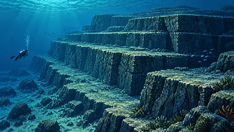
Yonaguni's submerged terraces resemble enormous steps cut into bedrock. The question is whether their geometry requires construction, and geologist Robert Schoch's examination provides a specific natural explanation.
After repeated dives, Schoch concluded that the main formation is primarily natural. He describes rock that separates along horizontal and vertical planes, producing the stepped appearance, and points to comparable features on land. His published account includes photographs of those above-water formations. Robert Schoch's Yonaguni field assessment.
Schoch also allows that people could have used or modified parts of the formation. That is a possibility in his interpretation, not a demonstrated construction date or identification of its builders. It should not be stretched into evidence for an engineered pyramid.
The comparison to inspect is between the submerged terraces and the island's exposed rock. A cropped photograph of one neat corner leaves out the surrounding geology that could explain it.
2. Bimini Road, Bahamas
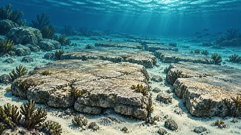
Bimini Road's rows of large stone blocks look like paving, but evidence from inside the stones supports a fractured sheet of beachrock. Beachrock forms when coastal sediment becomes cemented into solid rock, which can later break into separate blocks.
Geologist Eugene Shinn describes drilling oriented cores from the formation and examining their internal layers. The sediment layers dipped consistently towards deeper water, with distinctive pebble layers traceable between stones. That continuity supports an original natural deposit breaking apart, rather than independently quarried blocks being assembled into a road. Shinn's account of the Bimini investigation.
The formation remains visually striking without being a surviving section of Atlantis. Its regular appearance is a reason to study the deposit, not sufficient evidence of masonry. For an artificial-road interpretation to displace the geological explanation, it would need to account for the internal sedimentary structure as well as the arrangement visible to a diver.
3. Zakynthos “Lost City”, Greece
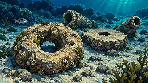
The supposed columns and paving near Alikanas Bay are mineral concretions, hardened masses that developed within sediment. Their resemblance to ruins prompted investigation, but laboratory analysis connected them to an ancient methane-seep system.
Researchers analysed the rocks using microscopy, X-ray methods and isotopes. The mineral composition and carbon-isotope results supported a process in which microbes consuming methane changed the sediment chemistry and encouraged mineral cement to form. The resulting pipes, discs and rings were later exposed by erosion. Andrews and colleagues' research paper.
The paper describes the formations as possibly Pliocene in age. That qualification is preferable to presenting an exact multimillion-year birthday as established fact.
This is also an example of biology helping to make a structure without an organism designing it. Microbial activity can change the chemical conditions around a seep; those conditions allow minerals to accumulate into shapes that resemble manufactured objects.
4. Pavlopetri, Greece
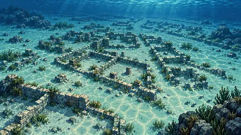
Pavlopetri contains a recognisable town plan, with buildings, streets and graves documented together. The archaeological case extends well beyond finding a collection of rectangular shapes underwater.
The University of Nottingham's project background records that the 1968 survey identified at least 15 buildings, courtyards, streets and burial features. Surface finds included pottery, stone blades and a bronze figurine. Those finds offered a Bronze Age date range, while the researchers cautioned that survey evidence alone could not confirm the dating of individual buildings. Pavlopetri project background.
Later work combined detailed mapping with closer study of the settlement. The project's 2009 survey record is a way to follow how observations develop into a fuller archaeological interpretation. Pavlopetri's 2009 field season.
A real town can still contain unanswered questions. Establishing human construction does not automatically establish the use of every room, the duration of each occupation phase, or the precise sequence by which the settlement became submerged.
5. Atlit-Yam, Israel
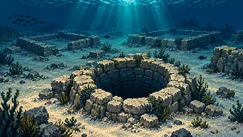
Atlit-Yam preserves evidence of people obtaining water, preparing food and burying their dead. These connected activities make the settlement identifiable as a lived-in place.
The Israel Antiquities Authority's excavation report describes stone-lined wells, rectangular buildings, graves, flint and bone tools, and food-processing objects. Animal, fish and plant remains help researchers reconstruct how its Neolithic inhabitants combined resources from land and sea. The report places the site roughly 200 to 400 metres offshore, in water about 8 to 11 metres deep. Atlit-Yam excavation report.
Its standing stones are only one component of that evidence. The report interprets a concentration of megaliths as probably associated with ritual activity. “Probably” should remain attached to the proposed function, even though human occupation of the settlement is well established.
That distinction applies throughout archaeology. Researchers can identify a human-built feature with confidence while continuing to investigate what it was used for.
6. Lake Huron Hunting Structures, United States
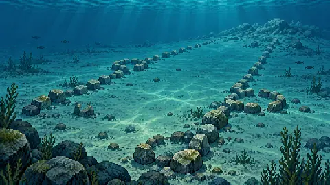
Stone alignments beneath Lake Huron preserve a landscape used by prehistoric hunters. Around 9,000 years ago, the Alpena-Amberley Ridge formed a dry corridor between Michigan and Ontario.
A 2014 study describes the Drop 45 Drive Lane, two parallel stone lines associated with hunting blinds. Investigators recovered 11 chipped stone flakes from the lane and its blinds, providing physical evidence alongside the layout. The authors interpret the arrangement as a way to guide caribou towards waiting hunters. O'Shea and colleagues' Lake Huron study.
The location is Lake Huron, not the often-circulated “Lake Michigan Stonehenge”. Treating those names as interchangeable would transfer evidence from one site to another.
Here, interpretation draws on the stones' placement within a former land surface and the associated worked material. A line of rocks becomes more informative when researchers can test how it relates to the surrounding terrain and human activity.
7. Thonis-Heracleion, Egypt
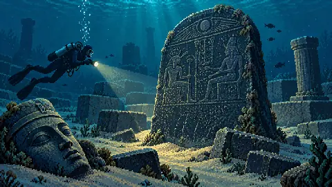
Thonis-Heracleion is a documented port city submerged in Aboukir Bay. The European Institute for Underwater Archaeology, directed by Franck Goddio and working with Egyptian authorities, located the site in 2000 and has mapped and excavated parts of it. Thonis-Heracleion project record.
The institute's research describes harbour basins, quays and a temple complex within the reconstructed city layout. These features connect the physical remains with the practical requirements of a port. IEASM research on the port's layout.
The discoveries also include inscribed material, such as the stele carrying the Decree of Saïs. Inscriptions provide evidence that can be studied alongside the architecture and objects, rather than relying on a structure's resemblance to an imagined lost city. The stele of Thonis-Heracleion.
This is a productive place to begin exploring actual sunken cities. Its research questions concern an identifiable human community, its trade and its changing coastal setting.
Farther west along Egypt's Mediterranean coast, researchers are reconstructing the Lighthouse of Alexandria from recovered architecture, ancient images and written accounts. The investigation shows how several kinds of evidence can restore the outline of a submerged monument.
How To Assess An Underwater Discovery Claim
Start by identifying what kind of image or object the claim is based on. A sonar map, a diver's photograph, a recovered sample and an artist's reconstruction answer different questions.
NOAA explains that sonar uses sound to map underwater features. Its exploration workflow then uses remotely operated vehicles to collect photographs, video and samples. Those stages complement each other; a striking sonar outline is a survey target, not an identification by itself. NOAA's explanation of mapping and follow-up exploration.
For a new claim, check five things before accepting the headline.
- Location. Look for a named site and a survey record. Similar-looking images from different places should not be combined as one discovery.
- Material. Find out whether researchers examined the rock, sediment or object itself. A claimed metal structure needs material evidence beyond its silhouette.
- Context. Check what was recorded around the feature, including associated objects and their positions. An isolated object cannot automatically explain an entire site.
- Dating. Identify what was dated. A date for sediment, shell or wood is not automatically the construction date of a nearby structure.
- Alternative explanations. Look for tests of ordinary geological and archaeological explanations, and for a clear account of what remains uncertain.
The cases above show how different checks can resolve different claims. Bimini's internal layers help explain its blocks. Zakynthos's chemistry explains its apparent columns. At the settlements and hunting sites, recorded human activity supplies the context that a geometric outline cannot.